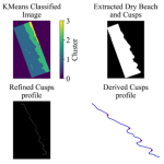
Shoreline Mapping Software provides a modern, efficient alternative and complement to traditional coastline monitoring, reducing the need for labor-intensive field measurements. Undergraduate student Noah Evans, with the assistance of graduate student Stephen Adusei and Dr. Nina Stark, is using CoastSat… Read More
NewsNews
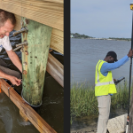
UF mobilizes team to study hurricane impacts in Florida
This is a re-post of the news article by Sharon Ryan on the Center for Coastal Solutions website. A joint team from the Nearshore Extreme Events Reconnaissance (NEER) Association and the Geotechnical Extreme Events Reconnaissance (GEER) Association, funded by the… Read More
Saurav Shrestha awarded Graduate Student Coastal and Ocean Research Fellowship
Graduate student Saurav Shrestha was recently awarded the 2024-2025 Graduate Student Coastal and Ocean Research Fellowship by Florida Sea Grant (FSG). This Fellowship Program focusses on advancing Sea Grant’s mission by fostering educational development and supporting ongoing research in coastal… Read More
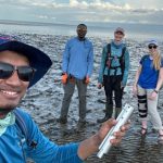
Florida mudflats and beaches surveyed on both Gulf and Atlantic coasts in July 2024
Over the summer, graduate students Stephan Adusei and Saurav Shrestha participated with other team members including Nina Stark (PI), Charli Pezoldt (research coordinator), Stefanie Wolf (visiting scholar), and Noah Evans (undergraduate researcher) in a four-day survey (July 18-19th and 24-25th)… Read More
Carson Clause develops python codes to find seabed sediment trends in sonar side scan data
Carson Clause, an undergraduate researcher at the University of Florida is using coding techniques and statistics to track trends and highlight seabed areas of interest from sonar side scan data. Through data-image processing and statistical methods, data from sonar side… Read More
Towards rapid tidal flat characterization from space
Tidal flats are important coastal features within the intertidal zone for recreation, ecological growth, and coastal protection. The sediment type and makeup of tidal flats can affect the strength of the flat and determine how accessible the flat is by… Read More
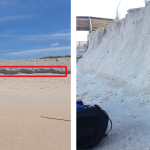
Initial Flagler County hardbottom survey
We successfully completed a demonstration mapping study of intertidal hardbottoms in Flagler County. A debrief report and presentation was provided to parties of interest. The work included bathymetric and topographic surveying, sediment characterization intertidal and subtidal, subbottom characterization in the… Read More