Earlier this month, the Coastal and Marine Geotechnics team participated in a four-day survey at Cedar Key, Florida. This survey is a part of an ongoing project funded by the Department of Defense Strategic Environmental Research and Development Program (SERDP).
Objectives of this project
Munitions and unexploded ordnance (UXO) remain in rivers, lakes, and oceans from past military operations and trainings. Some can and need to be removed, others are determined to be managed in place. Different technologies can identify and locate UXO on and in the seabed, but they can be affected by different seabed surface conditions. Similarly, the mobility or stability of UXOs is an important parameter to assess its risk. Detailed information about environmental and seabed conditions are needed to determine UXO mobility and risk for burial or exposure. The characterization of the seabed soil is particularly important due to its direct interaction with the UXOs as well as with surveying methods. Benthic biogenic processes can alter geotechnical soil properties on various spatiotemporal scales, introducing possibly significant uncertainty. This project aims to discover the complex relationship between geotechnical properties of soil and benthic biogenic processes, examining their influence on variations in erodibility and susceptibility to liquefaction, and thus, UXO and seabed interactions.
Fieldwork in Cedar Key, FL
An interdisciplinary team from multiple institutions conducted this survey. The Coastal and Marine Geotechnics group, led by principal investigator Dr. Nina Stark, included graduate students Rahi Rahman, Arianna Martin, Jaq Mueller, Stephen Adusei, Lea Eggensberger, Carson Clouse, undergraduate student Thomas Raffenberg, and research coordinators Charli Pezoldt and Todd Van Natta. Collaborators from the University of Texas Marine Science Institute included principal investigator Dr. Kelly Dorgan, graduate student Jennifer Duncan, and research technician Austin Wilson, and collaborators from Virginia Institute of Marine Science included principal investigator Dr. Grace Massey and graduate student Madison Sears.
Given the interdisciplinary nature of this project, a diverse range of data was collected. In-situ sediment strength was measured using a Portable Free Fall Penetrometer (PFFP), deployed from a boat during high tide and directly on tidal flats at low tide. During low tide, sediment samples were also gathered using 10 cm core tubes along defined transects across the tidal flat. Concurrently, in-situ measurements of moisture content, using a handheld moisture probe, and sediment strength, using the Soil Saber, were recorded. During high tide, 10 and 30 cm core tubes were used to collect sediment samples. These sediment samples were collected by snorkeling around the boat. Additionally, geoacoustic data was obtained during high tide using a Sidescan Sonar and a Dual Frequency Hydrographic Echosounder.
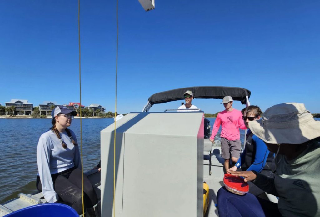
Data Collection from the boat during high tide.
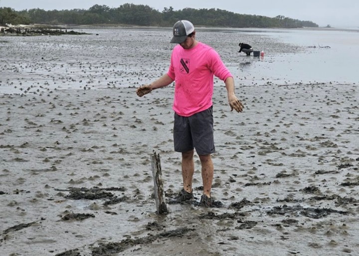
Undergraduate student Thomas Raffenberg dropping a Portable Free Fall Penetrometer (PFFP) in tidal mudflats.
Beyond these geotechnical and geoacoustic datasets, collaborators from the University of Texas Marine Science Institute collected benthic infauna to assess their influence on sediment properties. Meanwhile, the Virginia Institute of Marine Science team collected sediment cores for erodibility measurements and x-ray scanning, to enhance the understanding of sediment dynamics and bioturbation in the study area.
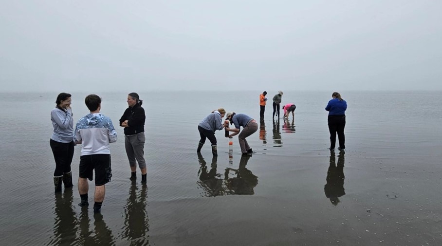
Data Collection during low tide.
These datasets will increase the understanding of correlations between biogenic seabed processes and geotechnical seabed properties, as well as correlations among geotechnical and geoacoustic properties, erodibility, and liquefaction under ocean wave action in shallow water (< 35 m) environments.