Sandy beaches host a variety of landforms shaped by local hydrodynamics. Among these, beach cusps are particularly notable. They typically form as rhythmic patterns consisting of elevated mounds (horns) and mild gradient embayments along the shore. These cusps not only create undulating alongshore topography but also alter the cross-shore slope, affecting local hydrodynamic processes and, ultimately, the overall evolution of the beach. These features can also affect beach trafficability relevant for search and rescue, recreational activities, and naval applications. Monitoring the dynamics of these features is essential for understanding beach evolution and erosion. Satellite-based remote sensing offers a cost-effective, rapid method to assess the geomorphodynamics of sandy beaches over large spatial and temporal scales. It remains effective even during restricted beach access or adverse weather conditions (particularly when using SAR imagery).
Graduate student Stephen Adusei is exploring how geomorphic features impact sediment properties with the goal of developing a model for beach trafficability assessment using high resolution satellite imagery. Figure 1 shows the steps in identifying and mapping beach cusps from high-resolution optic satellite imagery using K-Means clustering and basic image morphological filters. Figure 2 shows a similar approach employing image enhancement and morphological filtering to delineate cusp geometry from SAR imagery. Although the work is still in progress, these initial results indicate the potential of using high-resolution optical and SAR imagery to map coastal features and assess beach geomorphodynamics for various coastal applications.
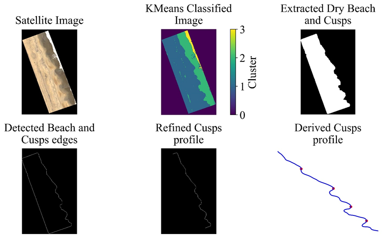
Figure 1. Beach cusps detection from optic satellite imagery using KMeans clustering and image morphological operators.
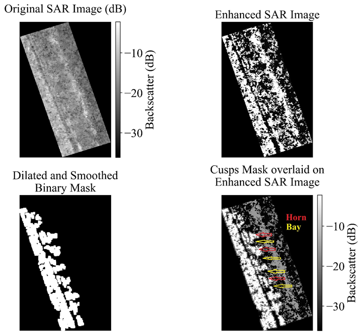
Figure 2. Beach cusps detection from SAR imagery.